UAS Tracking Solution
A comprehensive Air Space Management System for Low Altitude Remotely Piloted Aircraft (Drones) aligning with joint NASA-Stanford telemetry and ICAO guidelines.
Intelligent Low-Altitude Airspace Management
LK Simulations has implemented a comprehensive Air Space Management System for Low Altitude Remotely Piloted Aircraft, popularly referred to as “Drones”.
This solution covers all facets from registration, compliance, pilot certification, flight monitoring & enforcement, and awareness creation.
In addition, the LKSIM Air Space Management solution aligns with the latest developments & recommendations in Quad Tracking low altitude airspace management from the **NASA – University of Stanford joint task force** and **Nanyang Technology University (NTU), Singapore Study group**, as well as **ICAO guidelines**.
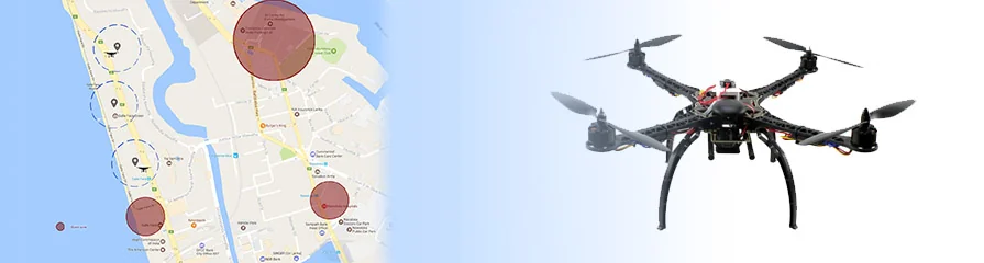
Simultaneous Target Telemetry and Real-Time Visuals
LKSIM air space management systems are packed with optimum features and functionalities. It supports identifying as many different targets as possible simultaneously, which is greatly helpful in navigating safely and detecting any flight anomalies.
LKSIM UAS tracking solution has dramatically helped improve the efficiency of aviation operations. It is enabled to collect real-time telemetry data, GPS information, and 2D/3D visualizations. This makes it possible to maintain records, view comprehensive target lists, and inspect individual UAS details.
Airspace Architecture Features
Highly configurable aviation frameworks compliant with modern safety and regulation protocols.
Real-Time History Viewer
Searching and filtering are supported in real-time and post-flight through this system's comprehensive history database.
Target Pair Mutual Calculation
Integrated mathematical calculators automatically compute relative distance and vector trajectories between multiple drones.
Custom Guard Zones
Define dynamic geo-fenced guard zones and airspace restrictions with immediate intrusion alarms.
Registration & Certifications
Full support for operator registrations, compliance checks, and pilot certificate listings in a secure backend module.
Emergency Landing Handler
Smart automation assist systems to guide drones and coordinate emergency landing zones safely during failures.
Operator Control Application
Companion operator dashboard allowing traffic managers to broadcast enforcement commands and raise safety awareness.
Pioneering Aviation Digitalization in Sri Lanka
While this may be a reasonably new technology in Sri Lanka, it is widely used, and solutions are required to maintain rules and regulations among the community. LKSIM works with local civil aviation bodies and private enterprises to scale out safe drone corridors.
Ready to Deploy an Airspace Management Corridor?
Talk to our aviation telemetry consultants to design a custom UAS tracking node conforming to international airspace guidelines.
Discuss Your Requirement